Drone Flight Plan
In 2017, an interest group on the use of drones for geospatial research was launched. Participants from MIT and Harvard met to discuss the current state of affairs, evaluate capabilities, and plan for the future.
One thing that became immediately apparent was that there were no official mechanisms for researchers, students, or anyone else to ask for permission to fly drones over the Harvard campus. Because federal laws were also in flux, it seemed like a good time to experiment with provisioning the use of drones over private property.
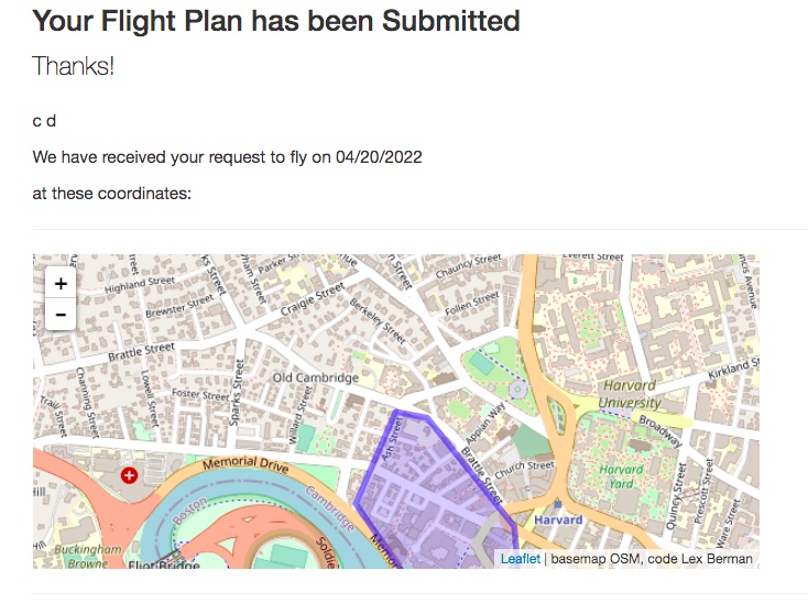
With this in mind, the UAV Flight Plan prototype was developed. It’s purpose was to combine a simple online form with a mechanism for drawing a rough flight plan and submitting it to a database.
Without having to invent the wheel, I experimented with the use of geojson.io as the input method for the flight plan coordinates.
This is a surprisingly versatile input mode. Dragging and dropping a .kml file or .shp file onto the geojson.io web tool will convert it to a geojson object. How cool is that?
Then submitting the form, through a little transformation magic can directly add the geojson object onto a Leaflet web map.
Result: a simple form with very few dependencies that will submit polygons (or other types of geojson features) to your backend system.
first version of this project was published 2017-06-22